

Glenkens News

Stroanfreggan hill-fort excavation planned
Carsphairn Heritage Initiative, in conjunction with the Glenkens Story are delighted to announce the launch of a new project investigating the ancient sites of Stroanfreggan fort and the nearby Smittons Bridge kerbed cairn!

Another chance to see The Glenkens Story Anniversary celebration
If you missed the chance to attend The Glenkens Story’s 10th Anniversary Celebrations on March 23rd (or would like to see them again) they now appear on the CatStrand’s You Tube platform.
The Glenkens Story - a time for celebration
We will be marking the 10 year anniversary of The Glenkens Story with an afternoon of celebration at the CatStrand on Sunday 23rd March.

Glenkens Youth Correspondent - Balmaclellan
What does Outlander's Sam Heughan, a witch and Old Mortality have in common? They have all got links to Balmaclellan; not bad for somewhere with a population of around 130 people! When I heard about the witch I had to find out more...
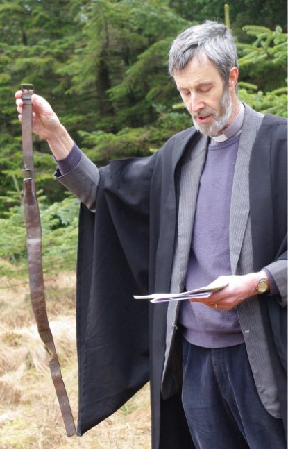
The Covenanters of the Glenkens
A review by Andrew Mellor of the book The Covenanters of the Glenkens by David S Bartholomew.
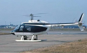
The 1983 Helicopter Crash
Just over forty years ago, a helicopter crashed on Mid Standard Hill near Balmaclellan.
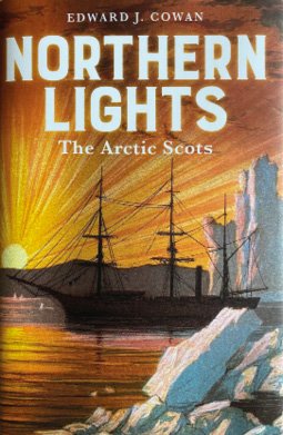
Northern Lights: The Arctic Scots
A review by Mike Brown of the book Northern Lights: The Arctic Scots by Ted Cowan.

War memorial research explored on Border Life
Local military historian Paul Goodwin highlights the importance of war memorials in a recent excerpt from Border Life on ITV News.

Using Historic Maps to travel through ecological time
This event on 18th September, delivered in partnership between the Galloway Glens Scheme and Dumfries Archival Mapping Project (DAMP), explores what pre-ordnance survey maps can tell us about what habitats used to be where and when, using four expert speakers to consider ‘Woodlands’, ‘Bogs’, Moths’ and ‘Meadows’ in Galloway in the 1700s.

Historic maps reveal land use changes in the Glenkens
The Glenkens Rectified Estate Mapping and Land Information Network (‘GREMLIN’) project has interpreted 44 estate maps from the 1800s, using the contents to measure and classify land use in the Glenkens 200 years ago.

Glenlair House hosts a tour and discussion of findings from the ‘Building Biographies’ Project.
On 7th July, twenty guests got a guided tour of Glenlair House, the home of James Clerk Maxwell, and heard from volunteers that have been leading the ‘Building Biographies’ research project, investigating the history of stately homes across Galloway.

Kenmure Castle: Witness to Galloway's History
Kenmure Castle, the most famous of the Glenkens castles, stands just south of New Galloway and has been touched by much of Scottish history. It was a Balliol stronghold in the wars of independence and was a refuge for Mary Queen of Scots on her flight from Scotland and was sacked by her enemies. It was sacked again by Cromwell for supporting the Royal cause and after the Jacobite uprising the 6th Viscount Kenmure was beheaded in the Tower of London for backing the rebels. Robert Burns predictably was a guest on his way to Kirkcudbright.

Air Crashes Near the Glenkens
Regular readers of the Gazette will know that I wrote a series of articles on Air Crashes in the Glenkens (issues 89, 95, 100 and 112). As these were well received, I thought that you might like to read about a few nearby air crashes, mostly in the Stewartry.

Glenkens Place Names - Plan of the Enclosures of Earlstoun and Barskeoch
In commemoration of the near completion of John Paterson’s splendid new house at Barskeoch, I intend to look at some placenames recorded on the Plan of the Enclosures of Earlstoun and Barskeoch belonging to John Newal Esq. This map was drawn by James Gregg in 1779 and is available on the National Library of Scotland website.